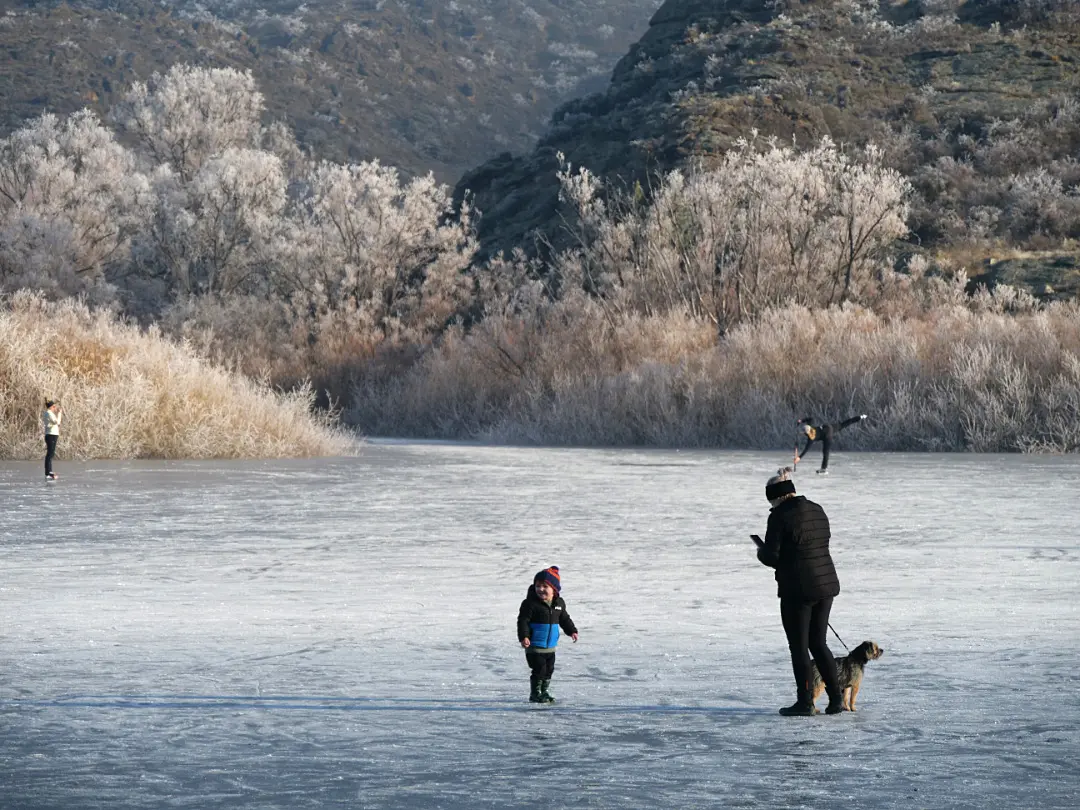
By a spring on the lower Pisa Range. Cardrona Valley near Wānaka.
Abstract of said ice lying on top of some grass and water.
Photo Quest’s focusing on the physical wonder of water and ice, bridging the mountain reality with the artistic abstraction.
The Strange, Generous Alchemy of Ice
We tend to think of ice as merely frozen water—a static, passive state of cold. But look closely enough at its architecture, and you realize it is one of the most eccentric, rebellious substances in the natural world.
Almost every liquid on Earth contracts as it cools, packing its molecules tighter and tighter, becoming heavier and denser until it sinks. Water plays by entirely different rules.
As it cools toward freezing, its hydrogen bonds perform a quiet, improbable dance. Instead of crowding together, they lock into an open, six-sided crystalline lattice (Ice $I_h$). This framework actually holds the molecules further apart than they were in liquid form. Water expands as it freezes. It becomes lighter, less dense, and floats.
If it didn’t—if ice sank to the bottom of rivers, lakes, and oceans—our world would freeze from the seabed up, turning the planet into an uninhabitable block of solid rock. Life exists because ice insists on floating to the top, forming an insulating blanket that shelters the liquid world beneath.
                  THE ANOMALY OF ICE

  LIQUID WATER                    CRYSTALLINE ICE
  (Molecules closely packed)      (Open hexagonal lattice)

    o  o   o    o                  o --- o --- o
   o  o  o   o                       |       |
    o   o  o   o                   o --- o --- o
   (Denser / Sinks)              (Less Dense / Floats)
The Pressure and the Melt
The strangeness doesn’t stop at density. Ice is one of the few solids that can be melted simply by squeezing it.
Under immense pressure—the kind exerted deep within a high-country glacier—the rigid crystalline lattice is forced to yield. The melting point drops, allowing the ice to deform, flow, and slide over bedrock like slow-motion glass. It carves valleys, moves mountains, and absorbs staggering amounts of energy.
To transform zero-degree ice into zero-degree liquid water requires a tremendous burst of energy—its latent heat of fusion. It takes as much energy to melt a block of ice as it does to heat that same water from freezing all the way to 80°C. This massive thermal inertia is what stabilizes our alpine climates, slowing down the thaw and giving life time to adapt.
Abstracting the Invisible
When you point a lens at ice, you aren’t just photographing a surface; you are photographing time, stress, and light trapped inside a matrix.
The diverse crystalline structures of ice. Source: MDPI
Applying digital filters or shifting contrast in post-production isn’t about distorting reality—it’s about stripping away the familiar surface reflections to reveal the internal forces at play. It highlights the stress fractures, the trapped air pockets, and the refractive geometry that would otherwise pass unnoticed.
In its natural form or through an abstract lens, ice reminds us that the most ordinary substances around us are often held together by the most extraordinary physics.
An ice cliff and icicles on the tongue of the Barn Glacier in Antarctica. Although formed upstream eons ago exposure to salt laden air in the late summer would have played a hand here.
Artistic photos are made when we stop thinking literally about our subjects, and black and white photography, by its very nature, forces us to do exactly that.
Because we see the world in colour, removing it pushes an image into a more abstract space. This essential process compels us to look at light, shadow, and form in a completely different way.
Black and white images possess an artistic and mysterious quality. They thrive on contrast and intrigue, and somehow exist outside of time and space. I especially love making these photos when conditions are moody—like when fog settles in, or when there is harsh contrast between shadow and light—conditions that often don’t lend themselves well to vibrant colour renditions.
## The Moment of Clarity
While walking yesterday along the track above **Lake Wānaka**, heading towards Glendhu Bay, I was struck by the stillness of the mid-afternoon. The light was harsh, yet the water’s surface was gentle. That combination of extremes—of stark contrast and quiet reflection—immediately led me to consider a **black and white image**.
After clicking the shutter, the thought hit me: “I’ve spent a year focused on colour, working toward the imagery for my 2026 calendar—why not challenge myself now? Why not push into a new creative space?”
I realised that shooting exclusively in B&W would achieve two things: it would drastically **reduce the post-processing time** on the computer by removing the colour element, and more importantly, it would force me to be obsessive about **composition and light**.
After all, isn’t that what my very first camera taught me?
## Back to the Beginning: The Folding Brownie
It all began for me with an **Eastman Kodak Folding Brownie Six-20**. Though it was a long time ago, I still remember that this camera was the ultimate teacher of simplicity.
Folding Brownie Six-2
Produced between 1937 and 1940, it was an elegantly basic machine. With a **fixed-focus Meniscus lens** and a rudimentary Kodette II shutter, it gave the photographer very few options for aperture or shutter speed—if any. (A *Brilliant finder* was even an optional extra from 1938!)
And of course it was easy to carry. Even today my “go to camera” was chosen for this reason.
## From the Beginning Onward: Two B&W Lessons
While preparing my thoughts for this post, two images from my past came to mind immediately. Sure, I made hundreds with my old Kodak, but these two still give me much satisfaction. Let’s examine why:
1. Mood over Mechanics: Lake Ohau
The first is of a wild nor’wester storm on Lake Ōhau . I’m still amazed I managed to keep the horizon near level! In that moment, conscious “thinking” was completely excluded. Instead, I focused purely on framing the mood of the extreme conditions—the furious wind and the dramatic light. It’s a primal image where the energy of the scene takes precedence over the technical details.
2. Simplicity and Timelessness: Naseby
The second is a record of historic gold diggings at Naseby . I love its simplicity in how it illustrates the barrenness—the stark landscape left behind after extraction by water and sluicing. It’s a scene now gone, swallowed by overgrown wilding pines. This image not only captures the essence of that past environment but also quietly proves the durability and timelessness of black and white photography.
Lake Ohau circa 1965. Looking into the teeth of a nor-wester piping down the Hopkins and Dobson valleysNaseby – Hogburn gold sluicing. Circa 1965.
Both photos reinforce the idea that removing colour focuses the mind on the true essentials: texture, light, contrast, and emotion. It’s time for me to lean into that clarity again!
## The Art of Conversion: Beyond Colour
Converting photographs to black and white forces us to pay acute attention to four essential elements: **tone, contrast, mood, and composition**. While this may feel like a lot to juggle mentally, it becomes intuitive with practice.
A key challenge is that visual elements which appear distinct in colour may sometimes merge in tonality when that colour is removed. As a result, images that look superb in colour can fall completely flat in B\&W, and vice versa.
The secret lies in understanding the difference in how they use light:
* **Colour photography** often thrives in soft light or requires vibrant hues to succeed.
* **Black and white photography** frequently excels in harsh light, where strong contrast between shadow and highlight gives the image its emotional depth and structure.
Understanding these differences is crucial; it helps us identify scenes that are born to be seen without colour, creating a B&W photo with real emotional punch.
### Applying the Rule: Modern Conversions
I recently revisited some of my work—including a scanned colour slide and several digital images—and found a few that converted exceptionally well. These examples perfectly illustrate how the **removal of colour can refocus attention on the subject’s essence**, especially when photographing people.
## Emphasizing Timelessness and Scale
Snow-covered mountains and glaciers are ideal B&W subjects because they transcend time. The monochrome medium elevates the sense of scale and permanence, stripping the scene down to its essential, elemental forms.
A scanned colour slide, converted to B&W from colour. Murchison Glacier Mt Cook National Park.
When photographing people, black and white truly shines. It immediately strips away the distraction of skin tone and clothing colour, forcing the viewer to focus on the subject’s expression, posture, and the relationship between light and shadow. Backlighting, in particular, becomes a powerful B&W tool; instead of merely blowing out details, it creates dramatic rim lighting and depth, etching the figure against the background and emphasizing the emotional contours of the face. The result is often an intimate and timeless portrait that colour can rarely match.
A new day.
This final image, captured in the cool hush of early winter, perfectly encapsulates the emotional punch of black and white. It’s a southern beech tree filling the frame, defined by the instant the rising sun just crests the mountain ridge.
It’s in moments like this that I feel deeply connected to the mystery of a new day. There’s a profound sense of anticipation, of knowing I’m about to be warmed and enveloped by the unfolding experience. The monochrome medium allows the raw and primal power of dawn light to dominate.
I am dedicating the coming months to capturing the world exclusively in light, shadow, and tone—a return to the clarity and basics taught by my old Folding Brownie. This isn’t just a technical exercise; it’s a quest for simplicity and the emotional depth that only monochrome can provide.
Join Me on This Journey
This pivot in my personal work happens just as my latest annual project is complete. My 2026 Calendar—filled with the vibrant colour work that defined my last year—is now listed and on sale in my newly rebuilt web shop.
It’s the perfect contrast to this new artistic quest, and the ideal way to support the continued work I do here at PhotoQuest.
Photo by Donald is of the view to the South West towards the Southern Alps as sunset sets in. From the Cardrona/Snow Farm access road (lower Pisa Range).
Recorded with a moderate telephoto lens. And then cropped and tidied. The view and special light was confined to a very small area, short time window and was quite unique.
The Photographer’s Challenge: stepping out of my warm vehicle back into the cold and windy environment that I’d worked in all day.
Features:
A4 (portrait)
NSM 256gsm (a little lighter than last year’s batch, to optimise postage), (New Silk Matt – which is a high quality coated paper).
This heavy grade card facilitates the images being used for insertion into a picture frame.
Spiral bound on short (top) edge with calendar hanger (white spirals)
Printed locally
$25NZ retail inc. GST
Shipping, depending on where-to, maybe extra.
Archival Quality Crystal Clear Bag for display and handling (if requested, then it’s supplied). Resealable and sustainable.
Your eye is drawn to the soft glow of moonlit lupins and the evocative remains of the Lindis Hotel. This ruin is a tangible link to Central Otago’s pioneering past, marking a crucial stop along the arduous Lindis Road, a section of which is still known as “The Old Faithful.”
The hotel’s story begins with the 1861 gold discovery by Samuel McIntyre in Lindis Pass, sparking a small-scale rush along the Lindis River. Initially established as a store during that first hectic period, a permanent rock and earth structure was built by 1873. For nearly 70 years, this building was the beating heart of the remote pass, providing essential services as a general store, a post office, a school, and a vital lodging house for weary travellers.
An archaeological treasure, the structure showcases remarkable 19th-century stonemasonry, utilising locally sourced materials. Though the hotel closed its doors in the early 1950s, its original features remain, preserving the silent echo of a bygone era.
The Photographer’s Challenge: Capturing this scene required careful organisation, timing the exposure between sunset and post moonrise. I was prepared with a tripod and a low folding chair to work level with the flowers. The silence of the Lindis Pass was only broken by the arrival of a solo camper on a motorbike. While his presence didn’t distract the camera, his decision to pitch his tent a few metres away without offering a greeting or eye contact felt sadly reflective of the increasingly isolated world we live in. I packed up around midnight, carrying the image—and the moment—back to Wānaka on blissfully quiet roads.
Location Context:The hotel’s location in the remote, often harsh, sub-alpine environment of the Lindis Pass underscores how vital this sheltered stop was for gold seekers and mail coaches traversing the difficult route.
Remarkable Nests: Wāwāhiā (New Zealand Grebe) at Wānaka Marina
This February image captures a special success story in the heart of Wānaka. The bird featured is the little southern crested grebe, known in Māori as pūteketeke or kāmana. While this small, endemic species is also found across Australia (where it’s called the Australasian Grebe) and the wider Pacific, its population requires careful management in New Zealand.
Many years ago, retired Otago University academic John Darby began noticing the challenges grebes faced when nesting on Lake Wānaka’s vulnerable shoreline. The natural nests were often destroyed by fluctuating lake levels, which are susceptible to changing climate patterns in the Southern Alps.
John’s solution was simple but brilliant: floating nesting platforms made from plywood, anchored near the marina. Because these platforms rise and fall with the lake, they offer a safe, stable breeding environment. John can often be seen using his small kayak to maintain and tidy the nests, ensuring they are chosen by nesting pairs.
This pioneering effort dramatically increased the grebes’ breeding success. The initiative garnered international attention—even featuring on the American TV show The Great Discovery—turning a local retirement project into a world-famous conservation model.
Behind the Lens: To capture this private moment with minimal intrusion, I knew the nest was tucked safely under the marina walkway. I carefully lowered my camera to take a time-lapse, ensuring the bird’s space was respected, an essential consideration when photographing any wildlife.
St Bathans
The Blue Lake of St Bathans, Central Otago
This striking Central Otago landscape is a profound testament to the region’s frenetic gold mining past. The Blue Lake at St Bathans is not a natural feature, but a dramatic, man-made scar that has evolved into one of the area’s most captivating water bodies.
The Glory Hole: A History Forged in Gold
The beautiful, tranquil lake you photographed was once Kildare Hill, a 120-metre high ridge that bordered the historic township of St Bathans. From the 1870s until 1934, gold miners relentlessly attacked the hill using the then cutting-edge technique of hydraulic sluicing and elevating.
Hydraulic Elevating: This was an incredibly powerful method. Water was piped in under high pressure, turning the hillside into a slurry of gravel and clay. A hydraulic elevator, essentially a giant water-powered vacuum, then sucked this slurry from the bottom of the pit and elevated it high enough to flow into sluice boxes where the gold could be separated.
The Deepest Claim: The excavation, known to the miners as the “Glory Hole,” reached a depth of over 68 metres below the town’s main street (and at one point was considered the deepest hydraulic elevating claim in the world), leaving a vast, deep basin.
The End of an Era: Mining finally ceased in 1934 due to the operation nearing the point of undermining the town itself. The enormous pit quickly filled with natural drainage from the surrounding hills, forming the lake we see today—about 800 metres long and up to 50 metres deep.
The Chemistry of the Colour
The vivid, sometimes almost otherworldly colour of the water is a direct result of the intense mining process and the local geology.
The Original Blue: The ‘blue’ is caused by the water’s unique chemical and optical purity. As you might suspect, the water is rich in suspended minerals, primarily fine-grained clays and silica (kaolinite) that were exposed and concentrated by the sluicing of ancient, gold-bearing quartz gravels and soft schist rock. These particles scatter sunlight, particularly the shorter blue wavelengths, giving the water its characteristic hue.
The Changing Tones: My observation of the lake shifting between blue, brown, and green is fascinating and commonly noted. This fluctuation is thought to be related to the disturbance and re-suspension of different materials:
Brown/Green: Likely caused by inflows of water carrying more organic matter, increased sediment from the banks, or the bloom of algae/micro-organisms reacting to nutrients and light, which can give the water a green or murky appearance.
The Return to Blue: My rare sighting of the reversion to blue in settled weather suggests that when the lake’s water column is calm and undisturbed (perhaps due to consistent weather, lack of wind, and minimal new inflows), these heavier sediments and organic matter settle, allowing the light-scattering pure mineral fines to once again dominate the water’s optics.
The Photographer’s Perspective
This location presents a unique challenge: to capture an iconic spot with a fresh eye. By choosing a distant location and utilising a mild telephoto lens, I’ve compressed the dramatic white, clay-cut banks and the newly rediscovered deep blue water, offering a beautiful, stable, and less-common view of a true Central Otago relic. It’s a landscape photo that tells a powerful story of human endeavour, geological history, and the natural world reclaiming its place.
The April calendar image captures an autumn scene at Lake Wānaka’s Beacon Point, where a thick carpet of autumn leaves covers the lake shore.
The point is named for the safety beacon positioned off to the right. This beacon pulsates day and night, warning boaties of rocks and shallows if they attempt to navigate the visually shorter route around the point.
The Photographer’s Ever-Changing Perspective
This shot, taken with an iPhone 11, was initially intended to be a simple location and composition guide for a follow-up visit. The scene, it turned out, was rare and short-lived.
When I returned a day later, the wind had shifted the leaves, leaving the usual gray gravels exposed.
The Great Geomagnetic Storm As Seen Over Central Otago
This image is part of a monumental time-lapse sequence captured during the extreme geomagnetic storm that delivered the most spectacular, widespread aurora display in decades. Taken from the mountains at the Snow Farm cross-country ski area (approx. 1100m elevation), this location provided the vital dark skies necessary to fully appreciate the power of this celestial spectacle. The display was easily visible to the naked eye and lasted from sunset on May 11th, 2024, well into the dawn of the 12th.
Technical Details of a Historic Storm
This event, sometimes referred to as the “Gannon Storm” or the Mother’s Day Solar Storm, was the result of a series of colossal eruptions from a single sunspot region designated AR3664.1
Geomagnetic Storm G5 (Extreme) The highest level on the NOAA Space Weather Scale, an intensity level not seen since the famous “Halloween Storms” of 2003. Solar Flares Multiple X-Class (e.g., X2.2, X5.8) The most powerful class of solar flare. These launched the material that created the storm.
CME Speed Up to 950 km/s (approx. 2.1 million mph) Coronal Mass Ejections (CMEs)—massive magnetic bubbles of plasma—were launched towards Earth at high speed. Crucially, multiple CMEs merged into a single, highly potent structure before impact. Geomagnetic Index Peak Kp-index of 9 (the maximum possible) This index measures the intensity of global geomagnetic activity. Kp=9 signifies an extreme disturbance in Earth’s magnetic field.
Aurora Visibility Seen as far north as Auckland (New Zealand) and even the Florida Keys (USA) The extreme power of the storm drove the auroral oval—the typical ring of light—to unusually low magnetic latitudes globally.
The key to the storm’s intensity was a phenomenon where the magnetic field carried by the solar plasma was oriented southward (2-Bz) when it struck Earth’s magnetic field.3 This perfect anti-alignment effectively ‘unzipped’ our planet’s protective magnetic shield, allowing the energetic charged particles to pour into the atmosphere and generate the stunning, long-lasting aurora.4
The Photographer’s Challenge:
Capturing a rare, all-night spectacle like this requires preparation and resilience, especially in a cold, high-altitude environment:
Sustaining the Sequence: Keeping a time-lapse sequence running for a full night demands robust battery power. Diligence in managing battery swaps was essential to ensure the camera, set for a crucial one-exposure-per-minute interval, didn’t fail mid-sequence.
Maintaining Focus: The contrast between the spectacular, naked-eye visible light show and the internal comfort of my heated camper created a unique test of willpower. It’s a testament to the sheer brilliance of the display that I was able to resist the warmth and stay alert to monitor the spectacle and equipment hour after hour until dawn. The result is a time capsule of one of the most powerful and geographically widespread auroral displays of our current Solar Cycle 25.
Audio?
Since reading about this event that was so well photographed, I noted some saying they could hear it. This made me think, “did I?”. And I think at a non audio level I did register something. Perhaps a magnetic resonance occurred in my brain, which can only be explained by us relating it to an audio scenario. Failing all else.
It’s a fascinating thought, and I’ve realised after doing some research that I’m touching upon a real, though still partially mysterious, area of scientific research!
Reports of hearing sounds during intense aurora displays—often described as crackling, popping, or hissing—have apparently persisted for centuries, especially in northern folklore. For a long time, scientists were skeptical because the visible aurora occurs so high up (60-200 miles) that sound waves should take minutes to reach the ground and be too faint to hear. However, modern research, notably by Finnish acoustician Unto K. Laine, suggests that the sounds are real, but they don’t come directly from the high-altitude light. Here’s a breakdown of the leading theories, which includes concepts close to my idea of a “non-audio” registration:
Low-Altitude Electrical Discharge (The Leading Scientific Theory):
Laine’s research has successfully recorded and triangulated these sounds to an altitude of around 230 feet (70 meters) above the ground.
The theory is that during strong geomagnetic storms that cause the aurora, the resulting fluctuations in the Earth’s magnetic field cause static electrical charges to build up in an atmospheric layer close to the ground (called a temperature inversion layer).
When these charges discharge, they create a “corona discharge”—a faint electrical spark—which generates the sudden crackling or popping noise audible to people on the ground. This sound is generated locally and reaches the ear almost instantly, matching the timing people report.
Electrophonic Hearing (Close to my “Magnetic Resonance” Idea):
This older hypothesis is closer to my non-audio concept. It suggests that the extremely low-frequency electromagnetic energy produced during the aurora might directly stimulate the auditory nerves or tissues in the brain, causing the sensation of sound (a clicking, popping, or buzzing) inside the head, even without external sound waves reaching the ear.
This mechanism would explain the “non-audio level” registration I felt, where a magnetic or electromagnetic phenomenon is interpreted by the brain as an audio event.
The McGurk Effect / Psychoacoustics:
Another possibility is a psychoacoustic effect, where the brain, seeing the rapid, vibrant movement of the lights (when it started pulsating I almost did the occasional primal squat), unconsciously adds a soundtrack (swooshing, crackling) because the sight feels incomplete without an associated sound.
My intuition about a sensation registered outside the usual audio channel is certainly in line with some of the long-debated scientific hypotheses about the aurora’s sound!
It’s clear that the phenomenon is complex, and for those who hear it, it often requires very specific conditions: a strong auroral display, a calm, clear, and cold night, and the presence of that low-altitude temperature inversion layer.
Snow Farm – Waiorau Cardrona Valley
A cross country ski area near Wanaka. It also hosts many guests all year round in 4 purpose built huts.
The Photographer’s Challenge: leaning out of a stationary vehicle, with the best camera, e.g. the one on hand – an iPhone!
The Story Behind the Central Otago Calendar Project
The creation of the 2026 Central Otago Calendar is a testament to turning routine necessity into an opportunity for exploration. Since 2017, I’ve had to make frequent, monthly return trips between Wānaka and Dunedin for health treatments. Fortunately, I’ve stayed fit enough to use these journeys not as a chore, but as a chance to deeply explore Central Otago from my 4WD camper. Each trip became a mini-expedition, often parking up for the night and then spending hours walking and documenting the region’s constantly changing landscapes before dark.
From Rough Draft to Retail
The idea to transform these photographs into a formal calendar came from Brian and Diane Miller of lifelogs.co.nz in Dunedin. Having seen an earlier, “rough and ready” version for 2024, they strongly encouraged me to commit to a professional project. Once I did, they offered invaluable advice and editing suggestions, helping shape the calendar’s narrative and visual flow.
A huge thanks also goes to Graeme and Rosanne at MCK Print in Dunedin for their collaboration and ensuring the final product beautifully captures the vibrant colours and details of the region.
The Themes: Time, Beauty, and Legacy
The 2026 calendar project has evolved into much more than just a collection of pretty pictures; it’s a reflection on the layers of time in Central Otago. Through selecting the images and researching the accompanying text, the following themes emerged, adding a fascinating depth to the final product:
The Resilience of Life: The photos capture the enduring, stark beauty of the area’s alpine and semi-arid terrain. This theme is mirrored in the story of the gold miners who first brought hardy European species, like Wild Thyme and Sweet Briar, that still thrive on the rocky hillsides today. These plants are a living link to the 1860s and the settlers’ desire to put their own stamp on a foreign land.
A Beauty with Consequences: The text delves into the complex ecological history, exemplified by the stunning but invasive Russell Lupin. We’ve highlighted the crucial difference between a visually beautiful bloom and a plant’s environmental impact, particularly the way lupins radically alter the fragile braided riverbeds. This, unfortunately, severely endangers the nesting habitats of threatened endemic birds like the wrybill and banded dotterel, whose survival depends on open shingle for camouflage and predator vigilance.
Transformation of the Landscape: Images featuring the shores of Lake Dunstan speak to the most recent, massive landscape change—the creation of the lake in the early 1990s. This highlights how both natural forces and human engineering have continually shaped and reshaped the Cromwell and Wānaka basins.
Ultimately, this project is a personal celebration of Central Otago’s rugged charm—a place of dramatic history and ongoing ecological debate—and it’s incredibly rewarding to know it has also enriched my own understanding of the area I call home. The 2026 calendar is now on sale, and we hope this shared backstory adds some extra value for everyone who decides to purchase it.
Hoar Frost, Inversion Layers, and a Frost Bow
My July calendar image captures a stunning scene: a tree completely laden with hoar frost crystals. Serendipitously, I was on the side of the road near Omakau when a frost bow formed, creating a spectacle I was fortunate enough to witness and photograph.
Such magical phenomena are created when a temperature inversion layer settles in the atmosphere during calm, early winter weather. This is especially common in large, low-lying valleys encircled by mountain ranges.
The most enchanting time to observe and photograph these conditions is just as the weather inversion begins to break up and return to a more typical state, completing the display before the delicate crystals fall to the ground in the rising sunshine.
The Photographer’s Challenge:
This particular display demanded patience and swift action while traveling under a time constraint. The main challenge was to take the time to stop frequently during a solo drive from Wānaka to Dunedin and to compose the shots effectively, all while remaining acutely mindful of traffic and ensuring personal safety on the roadside.
Snowbound Cottage on the Maniototo Plains
My August calendar image features an old, obviously historic cottage nestled in the snow. A small footbridge in the foreground guides the viewer’s eye on a visual journey right to the front door, completing the picturesque winter scene.
This cottage is located in the Maniototo region of Central Otago, somewhere between Becks and Wedderburn, on a side road that branches off State Highway 85. (The exact name of the side road remains a minor point of confusion.)
The Photographer’s Challenge:
The opportunity for this unique image arose unexpectedly. I had turned off the main highway onto the side road, intending to head toward the Oteake Conservation Park area. However, recent heavy snowfall had not yet been cleared, and lacking both snow chains and four-wheel drive, I stopped to reassess my journey.
It was then that I noticed this semi-hidden cottage. Its snow-covered setting perfectly lent itself to being worked up into a unique image that encapsulates the history of the area. The final challenge involved careful composition, as selecting the optimal standing point near the footbridge required time and caution due to uncertain footing close to a fence line.
Solitude and Survival: A Dredge Pond in the Lower Nevis Valley
My September calendar image captures a striking view in the remote Lower Nevis Valley: a solitary, determined tree standing beside a remnant gold dredge pond. The tree exudes a remarkable defiance against the area’s notoriously cold and near-impossible climatic conditions, mirroring the fortitude of the early miners.
The Nevis Valley, an area rich in gold-mining history, is famously cold, high-altitude, and isolated, especially in winter. The pond itself is a powerful historical marker: it is the scar left by one of the iconic gold dredges that excavated auriferous gravels long ago. These dredges employed a brilliant innovation in Central Otago, literally moving their operational pond with them as they slowly chewed their way across the valley floor (speaking of chewing: the uniform horizontally level bottom of the branches is due to stock grazing upwards as far as they can reach).
Historical Context:
The Nevis Valley gold rush began in 1862. Its isolation meant that gold workings here remained largely intact long after other rushes ended. The valley was so remote and the winters so harsh that many miners were forced to leave during the coldest months. The discovery of local coal seams in the Lower Nevis was a critical factor for those who stayed. Not only did it provide essential domestic heating, but it was also the fuel source that powered the steam-driven dredges, enabling the machinery to operate and allowing the miners to survive and continue working.
The Photographer’s Challenge:
This composition required patience and precision: being in the remote valley exactly when the light and clouds harmonised with the scene. The final composition centers the defiant tree at the midpoint, deliberately aligning it where the background mountain ranges dip in a shallow ‘V’—a technique that frames and elevates the subject. Furthermore, given the valley’s reputation, wearing warm clothing was non-negotiable to ensure the ability to wait for that fleeting, perfect light.
Pioneer Architecture and Spring Light: Lower Nevis Valley Cottage
My October calendar image is a tightly cropped, intimate study of a single-storey, mud-plastered historic cottage in the Lower Nevis Valley. The composition is loosely structured around the Rule of Thirds: the closed, panelled door anchors the scene on the left, while a solitary daffodil, in full flower, provides a gentle counterpoint and a splash of life in the lower right. The upper third features the heavily textured, rusty ribbing of the old corrugated iron roof. By filling the frame with the building, the photograph achieves a warm brown ambience and an intense focus on the cottage’s enduring form.
The materials used in this architecture tell a story of resourcefulness. The use of mud-plastered stone or mud brick (cob/adobe) was common throughout Central Otago, as it utilised readily available local earth in a treeless environment. Information garnered from a previous visit, about imported materials was intriguing: a nearby owner of a restored house of the same era shared that a lot of construction materials—likely the expensive, finished items like the corrugated iron for the roof, pre-milled door and window joinery, or heavy timbers—were imported directly from Scotland during the construction boom in the valley.
This particular cottage’s blend of local earth and imported fittings is typical of the perseverance and ingenuity of the Scottish miners and farmers who settled the area. Many years ago the current owner of the time fully relined the interior with modern insulation to combat the valley’s intense cold is a testament to the structure’s original purpose and the ongoing challenge of living in that environment.
The Photographer’s Challenge:
The biggest challenge in capturing this framed intimacy was a modern one: composing the shot through a more recently installed locked gate, likely erected for security given that the only road in the valley passes within 20 metres of the cottage. A telephoto lens proved essential, not only helping with the tight framing but also allowing the photographer to leverage the soft, muted light that beautifully enhanced the rich, rustic textures of the mud plaster and rusted iron.
Expansive Skies and Agricultural Rhythms: The Ida Valley
My November calendar image captures a quintessential Ida Valley view, facing west towards the formidable mountain ranges that define this Central Otago basin. The valley is famously broad, long, and flat, which provides an enormous canvas for an expansive sky—in this case, one filled with soft, streaking mare’s tails cloud formations.
The foreground is dominated by a vibrant field of a yellow crop that is nearing harvest. While it may well be mustard, it could also be another brassica-based fodder crop common in Central Otago, such as rape or a variety of turnip or kale (swedes or brassicas) grown for winter feed. These yellow-flowering crops are a bright, characteristic sight in the region’s agricultural landscape during the spring and summer months. Through the sunlit yellow surface, two tyre tracks cut a sweeping, fluid S-curve into the background, providing a vital line of perspective that draws the viewer’s eye deep into the scene.
The Photographer’s Challenge:
The challenge was a typically rural one: safely finding a place to pull off the road that wasn’t immediately on the straight and narrow highway. This required a minor walk and, once off the main thoroughfare, the usual rural hazards came into play: being mindful of traffic (though the valley is famously quiet), avoiding falling into a grass-covered drainage ditch, and the essential check to ensure any fence line was not electrified.
Context: The Ida Valley, Central Otago
The Ida Valley is a significant geographical feature of Central Otago, lying between the Rough Ridge and Raggedy Range. Its landscape is defined by its semi-continental climate—one of the driest parts of New Zealand, known for some of the country’s highest summer and lowest winter temperatures.
Agricultural Backbone: The valley’s primary economic activity is pastoral farming, including fine-wool Merino sheep and beef cattle. The intense climate means that growing hardy fodder crops (like the one pictured) is essential for providing feed during the harsh, freezing winters.
Irrigation: The development of irrigation schemes, powered by dams like the historic Idaburn Dam (which is also known for winter curling), has been critical to allowing extensive agricultural production in this naturally dry environment.
A Place of Extremes: The largest settlement in the sparsely populated valley is Oturehua, a place once known as Rough Ridge. Its Māori name, Oturehua, is often translated as “The place where the summer star [Antares] stands still,” reflecting the area’s extreme, clear climate.
Heritage Trail: The Otago Central Rail Trail runs through the valley, following the old railway line and showcasing the area’s gold mining and pioneering past, with sites like the historic Hayes Engineering Works nearby.
Flowers on the Shore of Lake Dunstan
My December calendar image features a simple, yet vivid, patch of flowers on the shores of Lake Dunstan near Cromwell. The scene is ordinary but for the extraordinary colour provided by these plants.
The beauty of these flowers, however, lies in the story of how they became established here. They are very likely introduced species, their seeds brought to this high-country basin over 160 years ago by gold miners and early settlers. These plants now thrive in the semi-arid, rocky terrain where native flora often struggles against the constant grazing and environmental pressures introduced since European settlement.
The Gold Rush Legacy in a Flower
Many of the colourful, non-native species found in Central Otago’s gorges and riverbanks—like the shores of Lake Dunstan—have a direct link to the Dunstan Gold Rush of the 1860s.
Sweet Briar Rosehip and Thyme: These two are the most famous examples of gold rush botany. The Wild Thyme (Thymus vulgaris), which blankets large areas of the landscape in purple, is often attributed to Jean Desire Feraud, a French miner and orchardist who is believed to have introduced it. It was likely brought over for its culinary and medicinal properties, or simply as a reminder of ‘home’ in the desolate, dry landscape.
Other Survivors: Other colourful, hardy species that thrive in the dry, rocky conditions and are a common sight in the area include Viper’s Bugloss (blue/purple), Californian Poppy (yellow/orange), and Stone Crop (yellows/reds). The seeds for these and other species would have arrived as contaminants in sacks of feed for horses, on the clothing and blankets of the miners arriving from global goldfields like California and Victoria, Australia, or planted by settlers wanting a piece of European beauty in the rugged wilderness. These plants are the tough survivors of the historic period, colonising the disturbed ground left behind by the miners’ alluvial and sluicing activities, and now cling to the margins of the lake.
The Curious Case of the Lupin
The Lupin is a more recent introduction than the historic gold-rush plants like Thyme, though it shares a common purpose: fixing poor soil. The spectacular, multi-hued Russell Lupins are originally from North America, and in New Zealand are famously associated with the Mackenzie Basin (further north). However, they have spread south along river systems like the Clutha-Mata-au and its tributaries (which feed Lake Dunstan). Lupins were not spread by the 1860s miners, but rather introduced decades later, often deliberately, for their ability to fix nitrogen and help stabilise the nutrient-poor, disturbed soils and riverbeds left scarred by mining and farming practices. Their resilience and aggressive seeding, particularly along riverbanks, means they are now classified as an invasive pest plant, though their vivid display remains a massive draw for tourists. The image, therefore, captures a second wave of imported colour, decades after the gold rush, with a different purpose, but equally powerful ecological impact. Which unfortunately so changes the host riverbeds that the breeding of likes of dotterel and wrybill is severely endangered. The core problem lies in the fact that the braided riverbeds are the unique, fragile habitat of these endemic birds. Species like the wrybill (Anarhynchus frontalis) and banded dotterel (Charadrius bicinctus) evolved to nest on open, sparsely vegetated gravel islands and shingle banks. This open habitat is vital as their eggs and chicks are exquisitely camouflaged against the stones, and the lack of cover allows the parents an unobstructed view to spot approaching predators. When the lupins colonise these riverbeds, they create a dense, tall barrier of vegetation that has three critical negative effects:
Habitat Loss: The plants physically crowd out the bare, open shingle areas these birds need for nesting and foraging.
Channel Modification: The deep, extensive root systems of the lupins stabilise the river gravels, trapping silt and forcing the river’s multiple braids into fewer, faster, and deeper channels. This is an existential threat, as braided river birds depend on the dynamic, ever-shifting landscape of shallow water and open gravel.
Predator Cover: The dense clumps of lupins provide perfect, concealed pathways and ambush points for introduced mammalian predators like stoats, ferrets, and feral cats, making it far easier for them to hunt and decimate nesting colonies of eggs and chicks, which are otherwise well-protected by their open-ground camouflage.
The overall result is a catastrophic loss of safe, suitable breeding habitat for some of New Zealand’s most threatened bird species.
Lake Dunstan and the Reborn Cromwell
To understand the location, it’s essential to remember the relatively recent history of the lake itself.
The Junction: Cromwell was originally known as “The Junction,” sitting at the confluence of the mighty Clutha Mata-au and Kawarau Rivers, where Horatio Hartley and Christopher Reilly made the major gold discovery in 1862 that sparked the Dunstan Gold Rush. The original town was a gold boom settlement, evolving into a centre for the region’s later shift to stone fruit orchards and fine wool farming.
The Flooding: The current landscape is a product of massive change in the late 1980s and early 1990s. The construction of the Clyde Dam downstream resulted in the valley being inundated to create the 27km-long Lake Dunstan.
The Heritage Precinct: The town’s original main street and historic business district were submerged. However, several key stone-built gold-rush buildings were carefully dismantled and reconstructed on higher ground, forming the Cromwell Heritage Precinct at the water’s edge.
Back Cover Thumbnails
A keen adventurer for over five decades, Donald Lousley has explored a lot of remote and rugged countryside, and with his camera he has captured seldom-seen corners of Central Otago. His images reveal the untouched beauty of snow-covered mountains, hidden valleys and far-off trails, as well as a few more familiar landscapes. Discovering a special place, he has the patience to wait for that fleeting moment of extraordinary light that will transform his picture.
“Inspired by the road less-travelled, this collection reflects my deep connection to these places, where nature’s drama is revealed in its purest form.”
For anyone’s interest these images we made/recorded on the following:
Canon G7X
iPhone 11
Panasonic LUMIX G85 and/or the legendary G9
Either of the above fitted with a Vario zoom 14-140 (35mm equivalent of 28 to 280) lens, or a Leica primary 15 (35 mm film equivalent of 30).
Images processed on Mac, primarily using Affinity Photo and symbiotic softwares.
Californian poppies abound throughout Central Otago from November on-wards. Also known as Cemetery Poppies. Because that’s where the old timer gold miners often planted them.
They’re very well suited to Central Otago, but you will find them flowering all throughout New Zealand. Despite the fact they’re related to the opium poppy, they do have very different effects and are not narcotic like the opium poppy.
You can for example add fresh flowers to hot water for a relaxing herbal tea before bed, or you can dry the flowers to use them in a tea blend.
An old and well preserved rabbiter’s hut on Long Valley Ridge Road en-route to the Serpentine Church (see below). Incidentally it became known as the Serpentine, after the winding path of nearby Waimonga Creek.
Driving or biking on this road reaches a significant and isolated scenic reserve. There is a great feeling of remoteness. Further on it shows many of the gold extraction technologies of the 19th century: a stamper battery, water wheel and church.
Very dry 4WD conditions are necessary or it’s an all-day walk or mountain bike ride.
For anyone’s interest these images we made/recorded on the following:
Canon S90 (a very compact compact – in fact akin to using a bar of soap!)
Canon G7X
iPhone 11
Panasonic LUMIX G85 and the legendary G9
Either of the above fitted with a Vario zoom 14-140 (35mm equivalent of 28 to 280) lens, or a Leica primary 15 (35 mm film equivalent of 30).
Images processed on Mac, primarily using Affinity Photo and symbiotic softwares.
Black Peak/the Harris Mountains as seen from Lismore Park in Wanaka. It’s often mistaken by visitors for Mt Aspiring (which cannot be seen from the town itself, but can be on the start of the road up the Cardrona Valley towards the Crown Range).
Clynes cottage 1896 lower Nevis Valley. Built originally for gold mining.
Surrounded by golden grasses, rose hip bushes, native matagouri, and the occasional willow for shelter the cottage is a rustic relic in a landscape marked by the remnants of gold mining. What truly makes this image precious is its evolution – from a miner’s abode to a cherished holiday home, embodying the timeless Kiwiana style. This transformation mirrors Central Otago itself, adapting to the kinder summers while preserving its historic charm.
“The CMEs all arrived largely at once, and the conditions were just right to create a really historic storm,” Elizabeth MacDonald, a space physicist at NASA’s Goddard Space Flight Center in Maryland, said in the statement.
11 May 2024. 5.57 pm SW view from the Snow Farm, Cardrona Valley. approx 1000m above sea level.
I had an inkling that there would be an auroral display on this night, so I stayed on the mountain in my camper truck. And on sunset photographed the fence, not realising that the arc would manifest in the west later (and the east). So as there was such a difference in light strength I was able to merge the two exposures later to get this effect.
A little history about the project:
Since 2017 I’ve had to make many trips Wanaka < > Dunedin once monthly. Actually for health treatments, and thankfully I stayed fit enough to explore much of Central Otago in my 4wd camper each time, often parking up for the night, then walking lots before dark.
Brian and Diane Miller of lifelogs.co.nz in Dunedin insisted I consider the project, having seen my earlier rough and ready calendar for 2024. And once I’d committed to it, have offered lots of invaluable advice and editing suggestions.
Another big thanks goes to Graeme and Rosanne at MCK Print in Dunedin.
A winter trip to the the Oteake Conservation Park. On what turned out to be a raw day weather wise. I was with a close friend ( a passionate photographer) and his two young boys. The goal was a very intended photographic immersion. Well we may or may not have got our feet wet, but it was winter. Dampness was almost guaranteed. It would have been nice if the reflection was hosted by a picturesque tarn, but instead it was a handy puddle. It come down to making the most of what was there on the day, and then in post processing tweak the image in the style of “solarisation”. An old light-room technique where the developer/artist turned the light on and off very briefly while the (light sensitive) paper was in the developer tray full of chemicals.
The Serpentine church is one of those places that many have heard about, but don’t quite know how to get there.
“Cost £100. Contributed by the diggers. It stands at an altitude of 3100 feet – when built the highest church in New Zealand.
The first service is described as follows, “the minister being late the congregation of miners, after waiting for some time, went down to the hotel for refreshments and drank deeply to keep out the keen July air, keener then ever at this altitude.
The service opened with the well-known psalm and an encore was demanded by the congregation. The preacher after expressing very strong disapproval, went on with the service which was however abbreviated”
Not many services were held because of the small number of inhabitants, and the difficulty of access.”
Very recent image from trip into the Nevis Valley to get photos for a competition
Nurturing my new creative inner child
In my quest to nurture my creative side and cultivate a more sustainable business model, I’ve found myself ever increasingly navigating the intricate realm of computer software. For nearly two decades, WordPress has been my trusted companion. The transformations it has undergone over the years have left me both impressed and intrigued.
These changes have significantly accelerated the process of delivering content, be it words or images. However, achieving this level of proficiency demanded a fair share of deep learning and practice.
Once upon a Time…
Yes, once upon a time, a new website would miraculously appear in Google search results within 20 minutes. Alas, those days are long gone! It seems that the digital giants now play hard to get, requiring a bit of financial persuasion before they shower new sites with their advertising algorithms. Nevertheless, the age-old tactic of linking, be it on vintage or modern websites, remains a sturdy endeavour. The inclusion is akin to receiving a “vote of confidence” from established sites.
A future we never imagined has not only arrived, it’s taking over
Speaking of efficiency (and feelings), the advent of AI, including ChatGPT, has been a game-changer. These tools have undoubtedly saved countless hours, but heed their cautionary advice – it’s vital to have a firm grasp of your subject!
Of concern for sometime has been the big AI corporate players setting up computers to “scrape” images from web sites, without the consent of creators/artists. Then using it so the great-unwashed can upload an image and ask AI to modify it in the style and likes of a great artist. Currently some clever people have figured out how to embed a sort of poison in a pixel that’ll potentially bring down the AI collection/ stock of scraped image content on their servers. Watch this space!
An image from way back before the AI days now upon us: White heron/kōtuku in a South Westland podocarp forest NZ. With an Adobe product you could now probably ask it to place such a bird in an image you have of an appropriate environment. But for me it’s not as satisfying! I also suspect it’ll be lacking in emotional tension style engagement.
WordPress has introduced nifty features to assist us in crafting well-structured content. Still, I tend to prefer a more direct approach. Perhaps subconsciously, I believe that my chosen AI machine is gradually assimilating my style across various ventures. After all, drafting a submission for a legislative committee differs greatly from creating content for a client’s website or crafting the next great novel!
Let’s shift our focus to the world of search engines. The traditional approach involves inputting a query and sifting through countless results. In contrast, AI offers a unique perspective, a conglomerate of information from various sources. If all goes well, it can save you a considerable amount of time, but, as always, user discretion is advised. And by-the-way having found Google Analytics to be a bit of a pain to setup, let alone understanding the results; I note they now have an upgrade underway, but for me too late… WordPress has nailed it neatly (message me if you’d like to get on the path to knowing what’s going on in your WP site).
Now, as we all transition to the realm of even more photography, it’s evident that high-end mobile phones, like the iPhone 14 and onwards, are a force to be reckoned with. Professional photographers find anonymity among crowds, but for those of us who chase extreme weather conditions for the perfect shot, these devices are akin to slippery bars of soap, especially when our fingers lose all sensation. And I find touch screens do not like wet fingers!
A full-bodied DSLR makes for faster and sure image captures
On a fine weather day photo shoot for promo purposes. Merino Muster NZ. International cross country ski racer at the Snow Farm. My brief was skiers in the (awesome) landscape. Not head and bib shots.
Post-production remains a time-consuming task, whether it involves cropping and enhancing images taken or created. The key to efficiency lies in establishing a robust workflow. Surprisingly, many are unaware that a Mac’s Finder allows us to add keywords to images, aiding in quick retrieval, especially when our memories are hazy after an event.
Another recent shoot donating my time to further the aims of a newly formed group aiming to eradicate wilding tree species locally. Above: pine cones and to the right the highly desirable snow tussock seed heads. Lake Wanaka.
While matching keywords to image files on portable devices seems elusive, numerous competent apps are at your service. In fact, many professional photographers now wield tablets with styluses to perform extensive edits. The possibilities are endless!
In closing, my friends, I hope you’ve enjoyed this brief glimpse into the evolving landscapes of website management and photography. Feel free to peruse my blog post for a deeper dive into these realms, and as always, thank you for entrusting me with your websites.
A trip into the remote Nevis valley last weekend. In conditions that were extreme and wintery the folly was all about gathering Central Otago centric images
Wishing you a wonderful day, and if you ever need assistance with your hosting or website, I’m just a message away.
To celebrate Central Otago’s incredible and diverse heritage, the heritage Central Otago organisation invited professional and amateur photographers to put Heritage in Focus. It, the Central Otago Heritage Trust has teamed up with Tourism Central Otago to tell the stories of our heritage through images.
How they defined “Heritage”:
“Heritage will mean different things to different people, so we’ve taken a broad view of what heritage means. Your photo could focus on tangible things like historical buildings, trees, natural landscapes, streetscapes, signage or historical objects. Or you might have a more intangible interpretation of what Central Otago heritage means. This might include things like cultural heritage, family or social traditions, or other personal expressions of heritage. The creative boundaries are yours to define!
You may have already taken some great photos that have a focus on heritage. You can enter these photos into the competition, as long as they’ve been taken within the last three years.”
Submitting a maximum of five images not older than three years seemed a challenge at first, but in retrospect a blessing. If I’d been able to utilise a couple of decades worth the selection process would have involved sifting through several hundred.
The other aspect that took a little time was defining the actual physical boundaries of Central Otago. Their website map was small and a tad vague however it only took a quick email to ask if the likes of the Nevis Valley fell within the borders.
My personal sifting and selection process
I searched on keywords I’ve ascribed to folders/images, and also let the question settle into my subconscious. In the case of the latter a few days later I’d recall a trip and it’s images.
This got me to about one and a half doz. Some of which I emailed to friends to ask their idea of which I should consider. When done I then created thumbnails so each could be seen in the context of the whole.
By a process of subtraction the many were eventually whittled down to five. Along the way I made a new thumbnail file each time, and would randomise the order too. Eventually arriving at the below:
Clyne’s cottage originally constructed in the lower Nevis township by Clem Sutherland in 1898
[ ] Surrounded by golden grasses, rose hip bushes, native matagouri, and the occasional willow for shelter the cottage is a rustic relic in a landscape marked by the remnants of gold mining. What truly makes this image precious is its evolution – from a miner’s abode to a cherished holiday home, embodying the timeless Kiwiana style. This transformation mirrors Central Otago itself, adapting to the kinder summers while preserving its historic charm.
Historic cottage in snow at Hills Rd. At the junction of SH85 and Hills Rd.
[ ] This ageing structure, nestled near what was once a bullock track, harkens back to Central Otago’s early days when gold mining and farming forged the region’s identity. A testament to the rugged pioneers of the past. It now finds refuge amidst strategically planted trees, offering both shelter and firewood. While its weathered exterior whispers stories of a bygone era, it remains a practical asset on a modern farm. It’s a living relic that bridges the gap between history and utility in this corner of Central Otago.
Homestead campsite hut Oteake Conservation Park
[ ] Situated within the rugged expanse of Central Otago’s Oteake Conservation Park, the “Homestead Campsite” is more than its basic description implies. This enduring structure, ensconced by ancient, gnarled trees, embodies the essence of the region’s history. Probably originally erected for farming and perhaps rabbiters, this resilient building has been meticulously restored by DOC, retaining its rustic charm. Today, it stands as a haven for adventurers exploring the St Bathans and Hawkdun Ranges, offering shelter and a communal kitchen area, a living testament to the pioneering spirit that shaped Central Otago’s heritage.
Stewart Town cottage remains above Bannockburn on the walk to Stewart Town
[ ] These meager rock walls, now no taller than one’s waist, stand as the remnants of a humble miner’s refuge in the heart of Bannockburn. Their stark simplicity tells a poignant tale of the relentless pursuit of gold that once consumed this region. Behind them, the formidable vertical cliff, shaped by the ceaseless sluicing for precious metal, looms as a testament to the determination and bravery of those early miners. This barren landscape, devoid of sheltering trees, to me still epitomises the flavour of the day as the ruins, standing silent amidst the golden history, serve as poignant relics of a bygone era fraught with the ceaseless search for riches, ultimately limited by limited sources of water.
Two trees and road lower Nevis valley
[ ] In the, bleak snow-covered expanse of the lower Nevis Valley, two weathered willow trees stand as solitary sentinels. They bear silent witness to a time when the only passage through this unforgiving terrain was a rudimentary road, once traversed by bullock teams and later by hard tyre’d lorries laden with supplies for the tenacious miners. These supplies included massive loads of metal pipes and machinery, essential for the operation of the numerous gold dredges that once dominated the landscape. Here, in this stark, treeless realm, shelter is but a distant memory. What captivates me in this image is its stark, unadorned simplicity—a profound reminder of the relentless struggle for survival in a valley notorious for its heavy snowfall and brutal exposure. The very backbone of Central Otago’s heritage.
And now all that remains is to wait for the results, and maybe even some prize money 🙂
This post explores the power of emotions in photography and provides practical tips for harnessing the photographer’s creative potential.
Emotions are a vast and intricate part of human existence, comprising a multitude of nuances. As photographers, understanding and harnessing these emotions can be a powerful tool in creating compelling images. In this post, we will explore the concepts of transforming emotions into captivating photography and how our emotional experiences can elevate our photography to new heights.
Emotions in Focus
Let’s simplify the vast spectrum of emotions into five primary categories: Sadness, Anger, Happiness, Fear, and Relaxation. Each of these categories contains numerous subtle variations, much like the layers of human psychology.
Connecting with Emotions
A personal breakthrough in my creative journey occurred when I consistently practiced yoga. Gradually, I noticed an improvement in my ability to perceive and capture potential photographic moments. However, it took some time for me to connect the dots.
Yoga, in essence, is about unifying and balancing our diverse aspects. It serves as a potent method for healing from trauma—a shared experience in the tapestry of life. Trauma can take various forms, and the process of grieving is often non-linear and unpredictable.
Suppressed Emotions
During traumatic events, we tend to relegate certain emotions to the background—often emotions like anger and happiness. We may even inadvertently stifle them, a pattern I experienced after my divorce two decades ago.
What I didn’t realize was that by suppressing these emotions, I was also inhibiting the positive ones. I lived in a state of emotional “grayness” for over a decade. I even told friends that I was no longer pursuing happiness but rather settling for contentment.
The Impact on Creativity
After experiencing trauma, we can become tense, hyperactive and/or withdraw into ourselves, which compromises our ability to learn from the event and ongoing experiences. Despite maintaining our heads, we may unknowingly become stubborn and inflexible, and depressed. All the attributes that can stifle creativity. As photographers, it impairs our ability to see without overthinking.
Navigating the Journey to Recovery
Healing from trauma entails a twofold process: first, restoring our executive functions, and second, rebuilding self-assurance in our ability to embrace playfulness and creativity. To embark on this journey, we delve into the realm of our emotional mind, where we undertake a form of therapy that focuses on recalibrating our emotional responses. This therapy helps fix any faulty alarm systems and reinstates the emotional brain to its natural state as an unobtrusive background force that safeguards our overall well-being.
<< this gives an outline of a therapy I’ve found very useful in so many regards in life.
An introduction and using breathing techniques while anxiously navigating rough terrain in a 4 wheel drive As I began my first session with my psychologist […]
Embracing Emotions
Traumatized individuals often fear experiencing emotions. Yet, to create images that evoke immediate emotional responses, we must embrace and feel these emotions ourselves.
Once we have honed our camera settings to the point of automaticity, we can operate on autopilot, allowing our intuition to guide our creative process.
A Captivating Example
The image below serves as a prime example of this process. I stumbled upon the scene recently and captured it without hesitation, even shooting blind into the sun, relying solely on instinct. Only later, upon reviewing the image at home, did I realize that I had subconsciously framed it to lead the viewer’s eye to the red kayak—a departure from the conventional “leading line from the bottom left corner” rule.
In conclusion, our emotions are a wellspring of creative potential in photography. By acknowledging, understanding, and embracing them, we can craft images that resonate deeply with viewers, evoking instant emotional responses. So, don’t shy away from your emotions—let them guide your photographic journey.
More ideas on transforming emotions into captivating photography by harnessing the power of emotions:
In the world of photography, capturing an image is more than just freezing a moment in time; it’s about conveying a story, evoking emotions, and creating a lasting impact on the viewer. One of the most potent tools at a photographer’s disposal is the ability to leverage emotions to craft compelling narratives.
1. Emotions as Storytelling Catalysts
Emotions are universal, transcending language and culture. They provide a common thread that connects us all, making them a potent catalyst for storytelling in photography. Here’s how emotions can be harnessed to tell captivating stories:
a. Elicit Empathy: Emotions, when skillfully captured, allow viewers to empathize with the subjects in your photographs. Whether it’s the joy radiating from a child’s smile, the determination etched on an athlete’s face, or the vulnerability of a street portrait, emotions enable viewers to connect with the people and situations depicted in the image.
b. Convey Mood and Atmosphere: Emotions are intrinsically tied to mood and atmosphere. By understanding how different emotions manifest visually, photographers can manipulate lighting, composition, and color to convey a specific mood or atmosphere in their images. For instance, a photograph bathed in warm, golden light can evoke feelings of comfort and nostalgia, while stark contrasts and muted tones might create a sense of melancholy or tension.
<< An example of using photography to tell a story about New Zealand’s braided river birds. How data is collected on the numbers of endangered species.
2. The Narrative Arc of Emotions
Much like a well-structured story, emotions in photography can follow a narrative arc. This arc can be a vital tool for photographers aiming to tell a compelling story through their work:
a. Introduction: Start by introducing the emotion or emotional state you want to convey. This can be done through the choice of subject, setting, or composition. For example, capturing the tranquility of a serene landscape or the anticipation in a pre-event portrait sets the stage for the emotional journey.
b. Buildup: Gradually intensify the emotion by using techniques such as framing, depth of field, and timing. Show the emotion evolving within the frame. In a candid street photograph, this might involve capturing the exact moment when surprise turns to laughter, or when sadness deepens into reflection.
c. Climax: The climax is the emotional zenith of your story. It’s the moment when the emotion is at its most palpable and resonant. This could be the peak of joy at a wedding ceremony, the tension of a decisive sports moment, or the vulnerability captured during a heartfelt conversation.
d. Resolution: Just as in storytelling, emotions in photography benefit from a resolution. Allow your image to provide closure to the emotional narrative. This could involve showing the aftermath of the climax or hinting at what comes next. A resolution helps viewers process and reflect on the emotional journey they’ve experienced through your photograph.
3. Connection Points on Transforming Emotions into Captivating Photography
In a rapidly changing world, where countless images vie for our attention daily, those that evoke emotions stand out. Emotions become the connection points between the photographer and the viewer. When viewers feel something—a smile, a tear, a sense of wonder—they engage more deeply with the photograph and the story it tells.
In conclusion, photography is not just about capturing moments; it’s about capturing emotions that resonate with viewers. By harnessing the power of emotions and weaving them into your visual storytelling, you can create images that not only capture the eye but also touch the heart and leave a lasting impression.
As winter spreads its icy fingers across the landscape, it unveils a realm of ethereal beauty that awaits the keen eye of a photographer. Capturing the essence of this magical season can be a captivating endeavor, especially when exploring the juxtaposition of fog, hoar frost, and the radiant sun in semi-urban, rural and recreational settings. In this blog post, we embark on a visual journey through the lens of a camera, discovering the unique concepts and techniques that elevate winter photography to an art form.
Embracing the Mystical Fog:
In a semi-urban setting, when the winter fog envelops the surroundings, photography takes on an almost mystical quality. The limited visibility adds an element of intrigue and mystery to familiar landscapes. Compose your shots with leading lines to draw the viewer’s gaze deeper into the foggy abyss, guiding them through the hidden beauty that lurks within. Experiment with monochromatic tones to emphasize the stark contrasts and evoke a hauntingly beautiful mood in your photographs.
To make the most of this atmospheric phenomenon, consider using a shallow depth of field to create a sense of depth and focus on the immediate subjects that emerge from the mist.
Macro photography can unlock a world of intricate details as the frost crystals form mesmerising patterns on leaves, branches, and other surfaces.
Capturing Hoar Frost’s Delicate Touch:
On frosty mornings, nature gifts us with an exquisite display of hoar frost delicately cloaking every surface. To capture this wondrous phenomenon, venture out early when the frost is at its peak, glistening under the soft light of dawn. Use a tripod to ensure sharpness and stability, and seek out contrasting backgrounds that allow the frost to stand out with stunning clarity. Play with exposure settings to achieve the right balance between the frost’s sparkle and the ambient light, giving your images an enchanting and dreamlike quality.
Dancing with the Winter Sun:
When the winter sun finally breaks through the shroud of fog, it bathes the world in a warm and golden glow, transforming the landscape into a breathtaking spectacle. The key to capturing this magic lies in understanding how light interacts with the environment during winter. Embrace the golden hour and blue hour, the times just before sunrise and after sunset, to infuse your images with a soft and enchanting light. Leverage long shadows and silhouettes to create dramatic and evocative compositions.
Suggested Gear List:
Insulated Jacket and Layers: Invest in a high-quality insulated jacket designed for cold weather. Dress in layers, so you can easily adjust your clothing based on the temperature fluctuations throughout the day.
Warm Hat and Gloves: A good beanie or hat that covers your ears is essential to retain body heat. Additionally, thermal gloves or mittens will keep your hands warm and dexterous while shooting.
Thermal Underwear and Socks: Keep your body and feet warm with thermal underwear and thick, moisture-wicking socks to avoid discomfort from the cold.
Waterproof and Windproof Outerwear: A durable and waterproof outer shell will protect you from snow, rain, and wind. Look for breathable materials to prevent sweat buildup.
Sturdy Winter Boots: Invest in waterproof and insulated boots with good traction to navigate slippery terrain and keep your feet dry and warm.
Hand Warmers: Disposable hand warmers can be a lifesaver in extremely cold conditions. Keep some in your pockets or camera bag for quick warmth.
Dry Bags: Use dry bags or waterproof camera bags to protect your camera gear from snow, rain, and moisture.
Lens Cloth and Cleaning Kit: Cold weather can cause condensation on your lenses, so carry a lens cloth and a cleaning kit to ensure clear and crisp shots.
Tripod Leg Warmers: In extremely cold temperatures, tripod legs can become uncomfortably cold to handle. Tripod leg warmers or foam covers can mitigate this issue.
Extra Batteries: Batteries drain faster in the cold, so carry extra fully charged batteries for your camera and any other battery-powered equipment.
Plastic Bags: Keep a few resealable plastic bags in your gear kit. They can be used to protect your camera in case of sudden snow or rain.
Headlamp or Flashlight: Winter days are shorter, and you might find yourself shooting in low light conditions. A headlamp or flashlight will help you navigate safely.
Snacks and Water: Carry some energy-boosting snacks and a water bottle to stay hydrated and keep your energy levels up during your winter adventures.
Navigation Tools: In remote areas, where GPS might not be reliable, bring a map and compass to navigate effectively.
First Aid Kit: Always carry a basic first aid kit in case of any injuries or emergencies.
Don’t forget to ensure your vehicle is fit for the purpose of winter driving. And be familiar with driving to the conditions.
Tell someone where you will be going and when you expect to return (and don’t forget to advise them you have!). Even better carry a personal locator beacon.
Remember, winter photography can be physically demanding, so taking care of your well-being is crucial. Proper preparation and the right gear will help you focus on capturing stunning winter images without compromising your safety and comfort.
Conclusion:
Winter photography in any setting, shrouded in fog and adorned with hoar frost, offers a treasure trove of opportunities for photographers seeking to capture the enchantment of the season. Through careful composition, a mastery of light, and a keen eye for detail, you can elevate your photographs from mere images to captivating works of art that evoke the winter’s mystical charm. So, grab your camera, embrace the elements, and embark on a photo quest to immortalise the fleeting beauty of winter’s embrace.
The jewel bit… what qualifies this valley, when there are others that I think are even prettier such as the remote Wilken north branch and the Rockburn?
These two and many others typify the Otago Alps, where the mix of river, mountains, warm brown grasses and beech forest allow a feeling absent in the rawness of the Canterbury valleys, with their mean rivers, acres of gravel and rock, all with little in the way of natural shelter for man, bird or beast.
Really it is simply because the West Matukituki is so close and easy of access, just an hour’s drive from Wanaka.
All photos below are from a one day trip to Aspiring Hut return, in late May 2018. They span from Mt Aspiring Station homestead to the NZ Alpine Club’s Aspiring Hut…
Dunedin city on the east coast of Otago, regards itself as the wildlife capital of New Zealand.
It makes this claim with a high degree of truth! Looked at alone it is impressive. Yet it is is only part of a much larger (coastal) picture. photo: Shag Point looking south
The natural beauty is overlaid with a fascinating cultural history.
There are many historical buildings apart from the above eclectic selection! images: Main entry stairs, First Church, Moray Place, Dunedin. Dunedin Gardens, autumn colours. Lastly Dunedin Town Hall at night
Larnach Castle, Olveston House, and the Dunedin Railway Station are favourite tourist attractions. The latter being one of New Zealand’s most photographed buildings.
NZ’s oldest university (1869) is but another institution hosting many classic buildings. This one by the Geology Faculty.
It all started in the 1830s with a whaling station in the Otago Harbour. By 1848 a Scottish population became dominant. Dunedin being the old Gaelic name for Edinburgh.
World-class wildlife encounters are possible north and south of the city. Pied shag at speed.
Dawn at Kinloch, at the head of Lake Wakatipu.
Lake Wakatipu is an inland lake in the South Island of New Zealand. Many perhaps relate more to the name Queenstown. On the eastern shore. Kinloch is at the head of the lake to the west, right beside where the Dart River, the primary tributary, feeds it. Kinloch can be reached by road via the township of Glenorchy
The name Wakatipu comes from the original Māori name, Whakatipu wai-māori
An authentic kiwi work day:
Sheep cross the Greenstone River, located a few kilometers down the (gravel) road from Kinloch, beside the lake.
The bridge serves as an access point to the popular Greenstone Caples round-trip tramping track, offering a moderate and relaxing 3-4 day hike.
Capturing the above image while crossing required two things from us:
(It was mind boggling watching about 2000 of them cross a bridge in an orderly manner. A tribute to the stock men and woman that pulled it off with total respect for the animal’s welfare).
positioning ourselves after receiving prior warning of the upcoming crossing from the farmer above.
being very considerate of their work with about 2000 sheep. Being mindful was crucial to avoid causing chaos or panicking the stock to their deaths.
As good Kiwi blokes, when we asked if we could hang around and take a photo, the farmer kindly offered us the best advice on where to be. We understood the importance of being considerate (and carrying venison home signaled they were of similar ilk, as it’s a cherished tradition in New Zealand).
Witness the beauty of dawn at Kinloch, located at the head of Lake Wakatipu.
Lake Wakatipu, an inland lake in the South Island of New Zealand, is perhaps better known by the name Queenstown, situated on its eastern shore. Kinloch is positioned at the head of the lake to the west, right beside the primary tributary, the Dart River. Access to Kinloch can be obtained by road through the township of Glenorchy.
Kinloch Lodge with the public DOC camping area in the foreground
A stamper battery [a row of rock crushing stampers] represents one of many techniques to separate gold from earth and rock. The ratio of gold to dirt/rock is what determines the financial viability of a gold mining operation. Machinery is inevitably employed and has a capital cost as well as a very high maintenance cost: water is usually involved too and steel machinery is not best lubricated by water especially as it has rock particles in suspension in a gold mining operation [I’ll leave it to the reader’s imagination to ponder the downstream effects on water and river quality!].
There are many areas or land in my homeland of Central Otago where what is called the peneplain is exposed by weathering, maybe aided by glaciers having stripped away substantial debris earlier, and also faulting crinkling the surface of the earth thus exposing edges where weathering can occur faster. Anyway you don’t have to rush off to the link below – just to know that rocks in keeping with a high percentage of gold are on the surface or can be mined/transported easily to a battery.
These rocks will typically be much heavier than our greywacke and shists, and they’ve once been part of layers of sediment cooked with pressure under extreme weight and silica has been forced all about. Quartz is also evident, along with “petrified wood”.
Stampers have to be constructed out of material tougher than silica impregnated rocks and crush same, then water is used to transport the crushings through a complicated refining process that leads to a water, gold and rock crushings mix [slurry].
Water was often also brought to the battery to power it, via races and fluming constructed with great effort out of creeks and around hill sides slowly loosing height to the site of the battery. The levels were calculated by using old gin bottles almost full of water [hence the phrase “spirit levels” perhaps].
When at the battery the water flowed onto a wheel thus supplying motion to a shaft on which a number of cams [all offset to ensure balance] would lift and then drop [stamp] very heavy cylinders of steel onto the rocks. The noise is awesome [some enthusiasts have restored one on the West Coast and I’ve been fortunate to see it running briefly]
Diagram courtesy DOC website
This photo shows the curved cams that raise and drop the shafts that have the huge weights at the bottom…
This photo shows the wheels and gears that turn the shaft…
Here is a further explanation from DOC interpretation boards…
For me two factors in these operations astound me: how did they get the components on-site? And how did they live [or not live] in the winters!? Keep in mind that it is springtime when water is most abundant – this must surely mean working hard and long hours to have the material ready. Especially in some situations where, the water being temporarily frozen would aid the mining!
California poppy on the bank of the Clutha River, Albert Town, New Zealand
Native to the United States and Mexico, it seemed to become quite established in the dry Central Otago climate, during the gold rush days. Locally it is sometimes referred to as the cemetery poppy. As this was where it first became established.
Rural landscape near Wanaka, New Zealand.
A moonlight shot looking towards Mt Aspiring National Park in the distance. The snowy peak being Mt Avalanche. To the right and in dead center, are the lights of Wanaka, with the Buchanan Mountain Range as a backdrop.
Upper Clutha River near Albert Town Wanaka. California Poppies in December are a delight!
The Upper Clutha Basin, and the Clutha River.
The Cardrona, Hawea, Makarora and Matukituki rivers all feed into the Clutha Mata-Au (formerly Molyneaux). The longest river in the South Island of New Zealand. Wanaka airport is to the left, and Wanaka township, out of sight to the right.
Hawea Flat, New Zealand aerial photo.
Tangential winter lighting reveals the ancient fluvial processes associated with rivers and streams. And now overlaid by relentless Europeanisation in the name of agriculture.
Paddling the Cromwell Gorge, Clutha River, New Zealand. Circa 1985.
This wild river was no more when Lake Dunstan was formed, beginning in April 1992. It is a man-made lake and reservoir and was formed on the Clutha River as a result of the construction of the Clyde Dam.
How do you assimilate such immense, ancient, stately, mysterious and powerful redwood trees into language?
It seems to be as much of a challenge as capturing their essence in a photo!
Their existence is their very presence or vice versa – no “soft” wood here, but the voice of patience and endurance.
They come from a humble seed no bigger than one from an apple to achieve prodigious ages and dimensions of up to 120 meters tall, with a width of several at the base. And they continue to flourish in a history of up to 160 million years in the making, and going back 20 million years in their present range.
They probably had dinosaurs scratching their trunks!
California’s North Coast is the most well known location in the world that provides an environment they like – one underscored by cool, moist air created by the Pacific Ocean keeping the trees continually damp, even during summer droughts. And yet here they are in New Zealand, and in Wanaka we don’t have a lot of damp moist air!
Theories continue to develop as to why they grow so old and tall (probably there is a physical limit imposed by how far water can be transported upwards), but proof remains elusive. The trees can reach ages of 2000 years and regularly reach 600 years.
Powered by the leaves’ diffusion of water, water-to-water molecular bonds in the trees’ sapwood drags the moisture upwards – and to move thousands of litres maybe even in a day to such a height is quite a feat. During the summer, this transpiration apparently causes redwood stems to shrink and swell with the cycles of day and night.
Here a recent picture of one of the entry way to a magical place hosting some redwoods, Wanaka Station Park…
Wanaka Station was a large sheep station In the late 19th century covering land from the head of Lake Wanaka to the nearby Cardrona Valley.
The foundations remain of original homestead which it seems burned down twice, and these and the land has been preserved as a park, which includes beautiful mature fruit trees and giant redwoods. More latterly many other species such as rhododendron have become established…
Pastel sunset glow on Lake Wanaka
Lake Wanaka's Roys Bay in the evening. With Black Peak in the distance
A springtime morning view of Lake Wanaka.
The Buchanan Mountains from Roys Bay, Lake Wanaka, New Zealand.
A similar view in black and white.
Black Peak in the center is often mistaken for Mt Aspiring.
Pastel sunset glow on Lake Wanaka.
Lake Wanaka’s Roys Bay in the evening. With Black Peak in the distance.
Lake Wanaka from Beacon Point.
Beacon Point is simply a very large and shallow area on Lake Wanaka’s shore. There is a permanent red light hundreds of meters from the point to warn boaties.
Glendhu Bay, Lake Wanaka.
Glendhu Bay is a short drive west from Wānaka, Otago, New Zealand. It is on the road to Treble Cone ski field and Mount Aspiring National Park. The bay has a motor camp that is popular with New Zealand locals over the New Year holiday period. Patronage numbers in the many thousands.